


The region stretching between Lake Van and Ani, the medieval Armenian capital, was once filled not only with Armenian villages but also with monasteries, churches, and chapels. Some of these were destroyed already during the Armenian Genocide of 1915 and its aftermath, such as Varagavank; others were blown up during the wave of cultural genocide in the 1950s, such as the Monastery of Mush. Yet the ruins of many churches still survive to varying degrees. A significant number lie within the border zone, where access is prohibited, while most of the others stand on remote mountain slopes far from inhabited areas and reachable only after a long hike – a circumstance that has partly contributed to their survival.
 The Church of Saint Shushanik in the closed border zone, photographed from the road
When traveling alone in Eastern Anatolia, I usually make time to visit one or two such monuments. When guiding a group, this is rarely possible: either time is short or the spirit of adventure is lacking. But this time the group is so eager to explore that we decide to devote the time to visiting a relatively accessible monastic ruin.
The Monastery of Khtzkonk (Խծկոնք) was built near the village of Digor – Tekor (Տեկոր) in Armenian – about twenty kilometers from the present Armenian border and roughly forty kilometers southwest of Ani, in the deep canyon of the Digor (Tekor) stream, which flows into the Arpaçay (Akhuryan), the border river near Ani. The monastery was founded in the seventh century and continuously expanded until the thirteenth. It possessed five large churches, from which it derived its Turkish name Beşkilise, “Five Churches.” Only a single photograph survives showing the monastery and its five churches intact. It was taken by Ashkharbek Kalantar, who participated in the excavations of Ani from 1907 onward and later rescued the archaeological finds to Tiflis in 1918 ahead of the advancing Turkish army. He was the last scholar to travel through and document the Armenian monuments of the region before their destruction and the disappearance of the Armenian population.
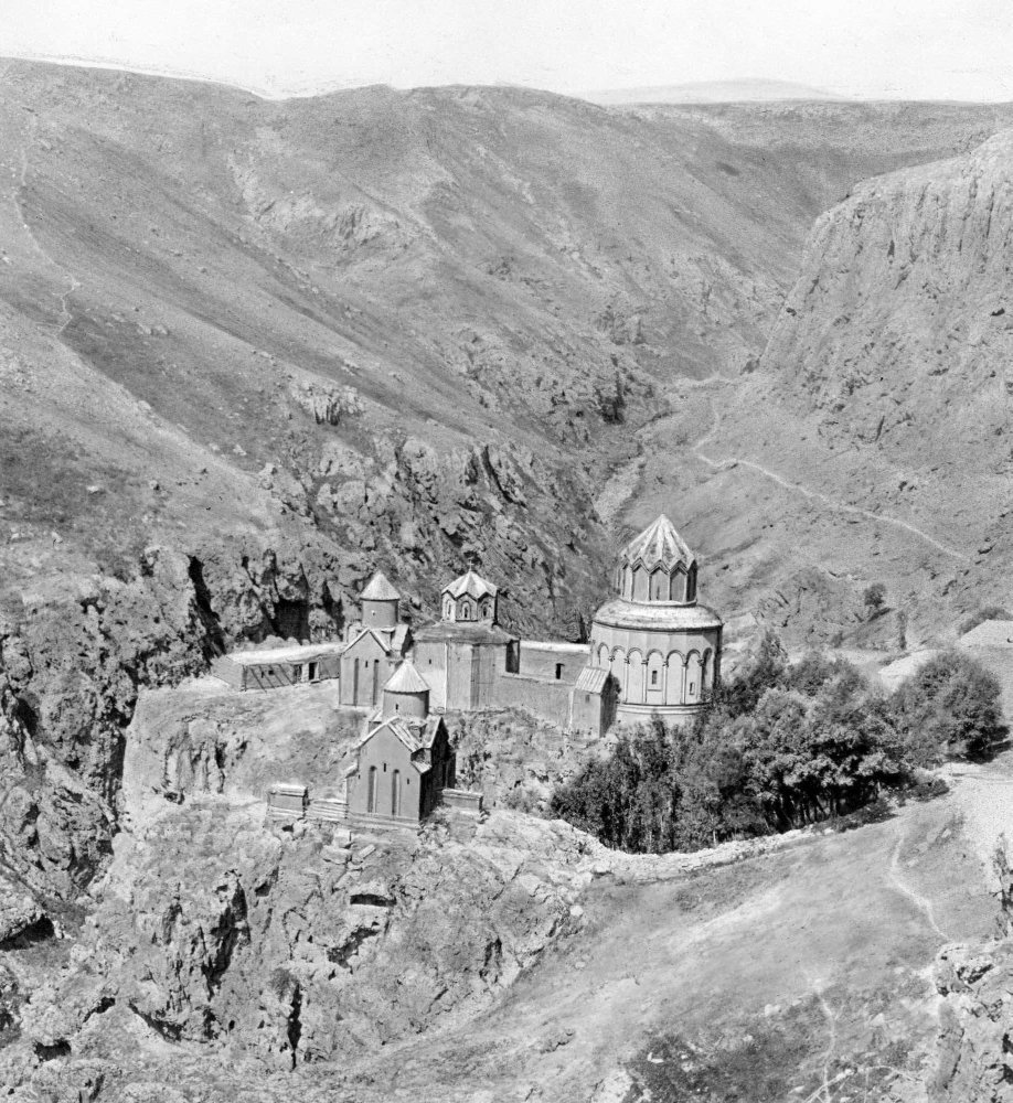
All five churches followed the characteristic Armenian Greek-cross plan. The oldest was dedicated to Saint John the Baptist and was built sometime between the seventh and tenth centuries. The earliest inscription on its walls dated from 1001 or 1006 and mentioned Katranide, the wife of the Armenian King Gagik (989–1020), the great builder of Ani. The small Church of the Mother of God dated from the tenth century. The tenth–eleventh-century Church of Saint Stephen stood on a separate rock lower down and is not visible in the photograph above. Around it stood khachkars marking the graves of Christian martyrs massacred during the Seljuk capture of nearby Ketchror (modern Tunçkaya) in 1208. The tenth–eleventh-century Church of Saint Gregory the Illuminator was also surrounded by a walled cemetery containing an especially large and richly carved khachkar dated 1031. A few fragments of this church still survive; its cemetery was destroyed by treasure hunters in 1986.
The region belonged to Kars, which remained under Russian rule until 1920, and therefore escaped the Armenian Genocide of 1915. Its Armenian inhabitants fled only then, before the advancing Turkish army, and the monastery remained largely intact. It was only in the 1950s that it fell victim, together with many other surviving Armenian churches, to the wave of cultural genocide that swept across Eastern Anatolia. Four of its five churches were blown up by the military, and their rubble was hurled into the depths of the canyon.
Of the five churches, only one still stands: the largest, dedicated to Saint Sarkis, the Cappadocian Byzantine general who suffered martyrdom under the Persian shah Shapur II in 362 and is especially venerated in the Armenian Church. According to Armenian sources, it was founded in 1025 by a certain Prince Sargis. The earliest inscription on its walls dates from 1033; another, from 1211, commemorates the recovery of the monastery from Muslim control. Finally, an inscription of 1214 records that Davit, son of Grigor, a general of the Zakarians – the chief commanders of Queen Tamar – was so impressed by “the splendor of the holy monastery of Khtzkonk” that he donated half the village of Vahanardzesh to the church for the commemoration of himself and his parents. Abbot Hovhannes accepted the donation and ordered an annual memorial liturgy to be celebrated for them.
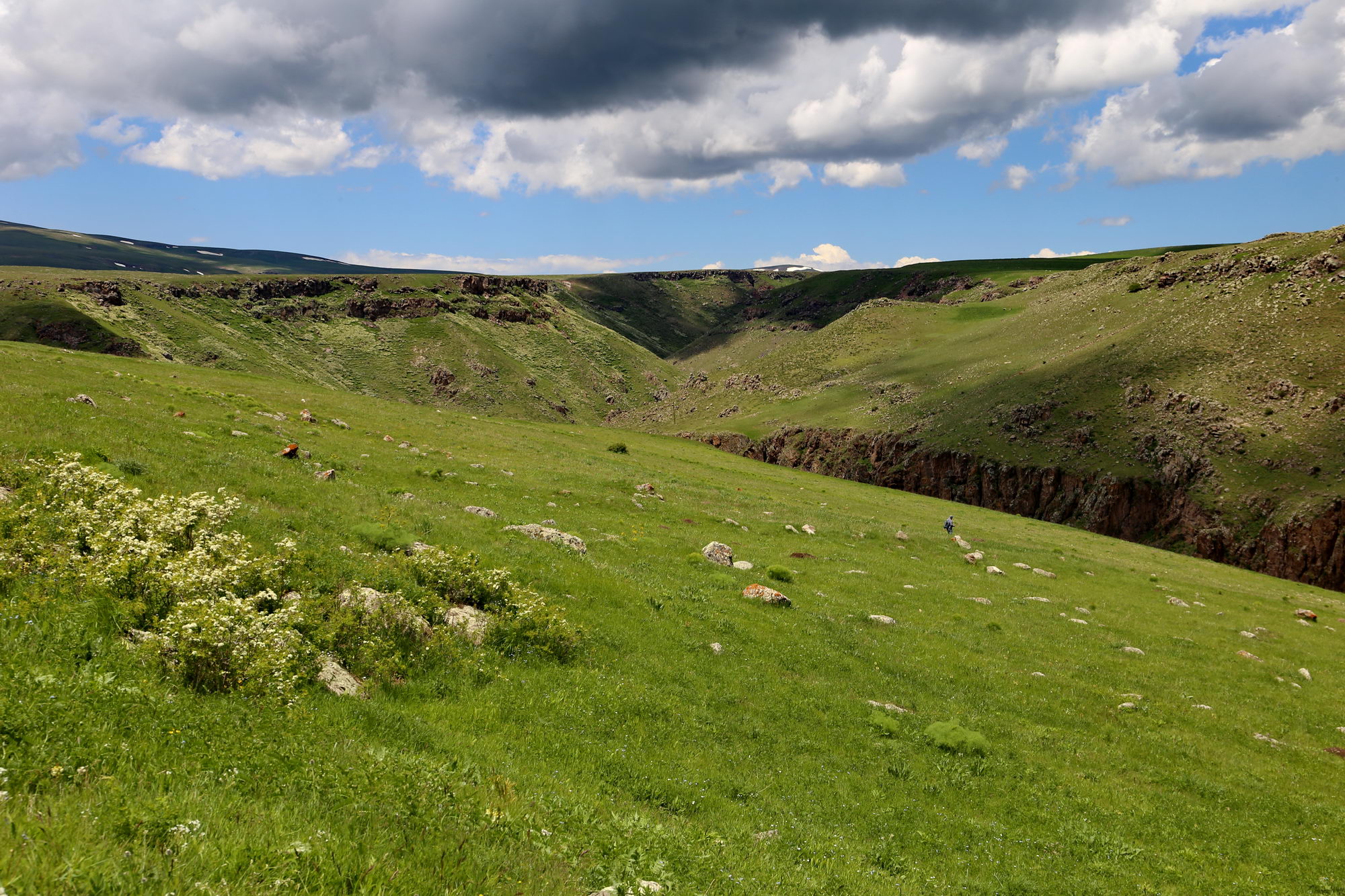
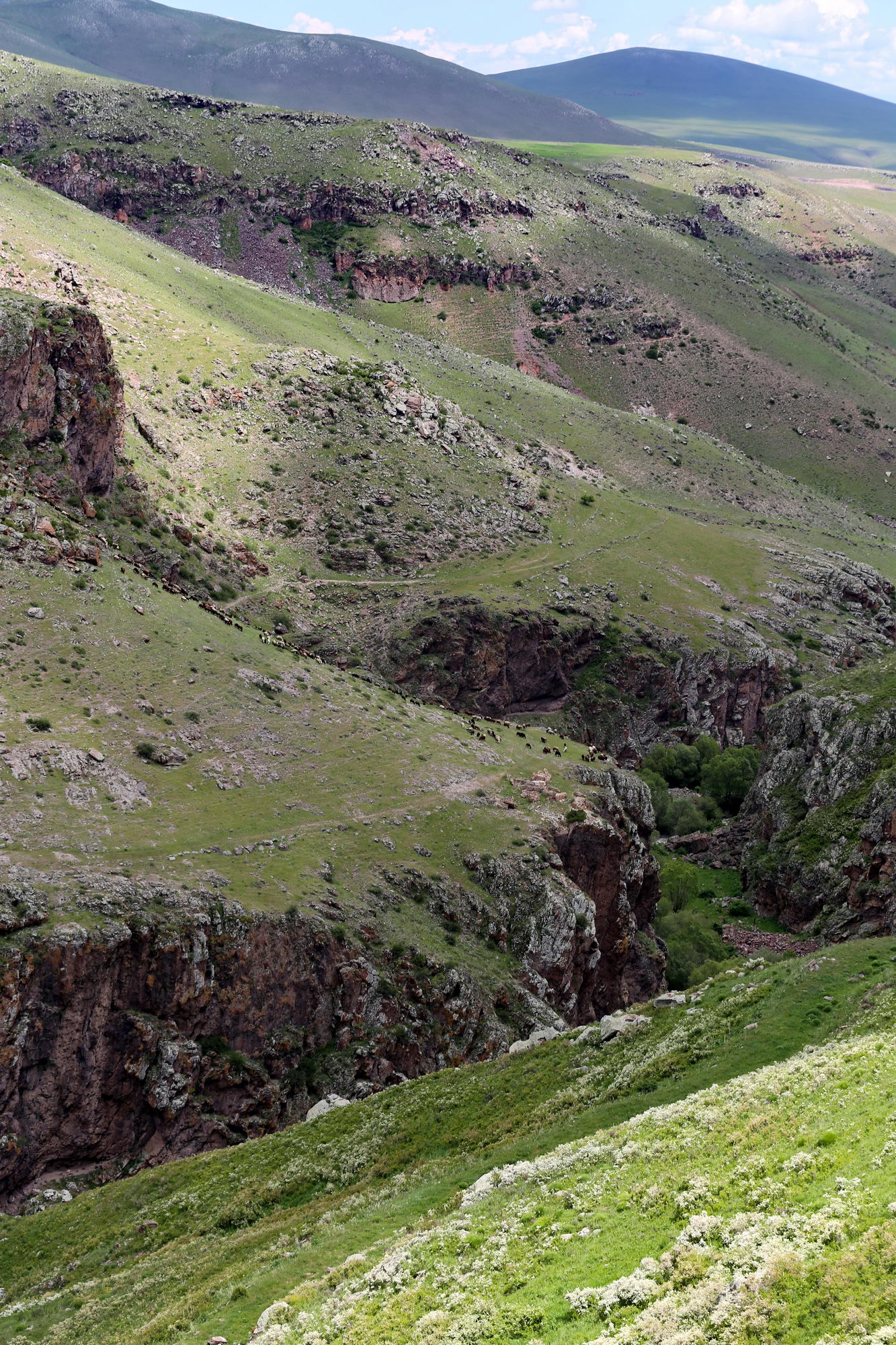
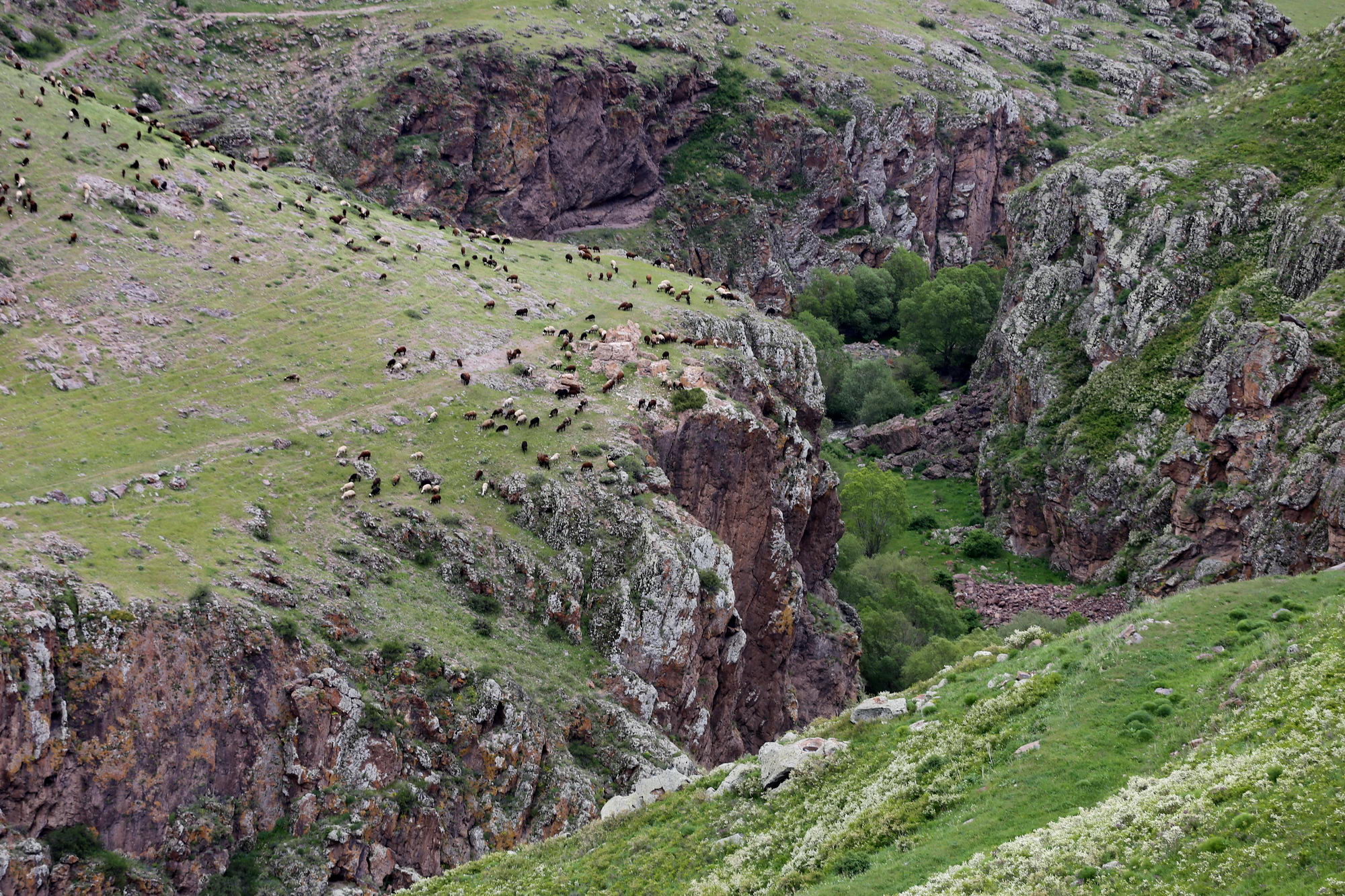
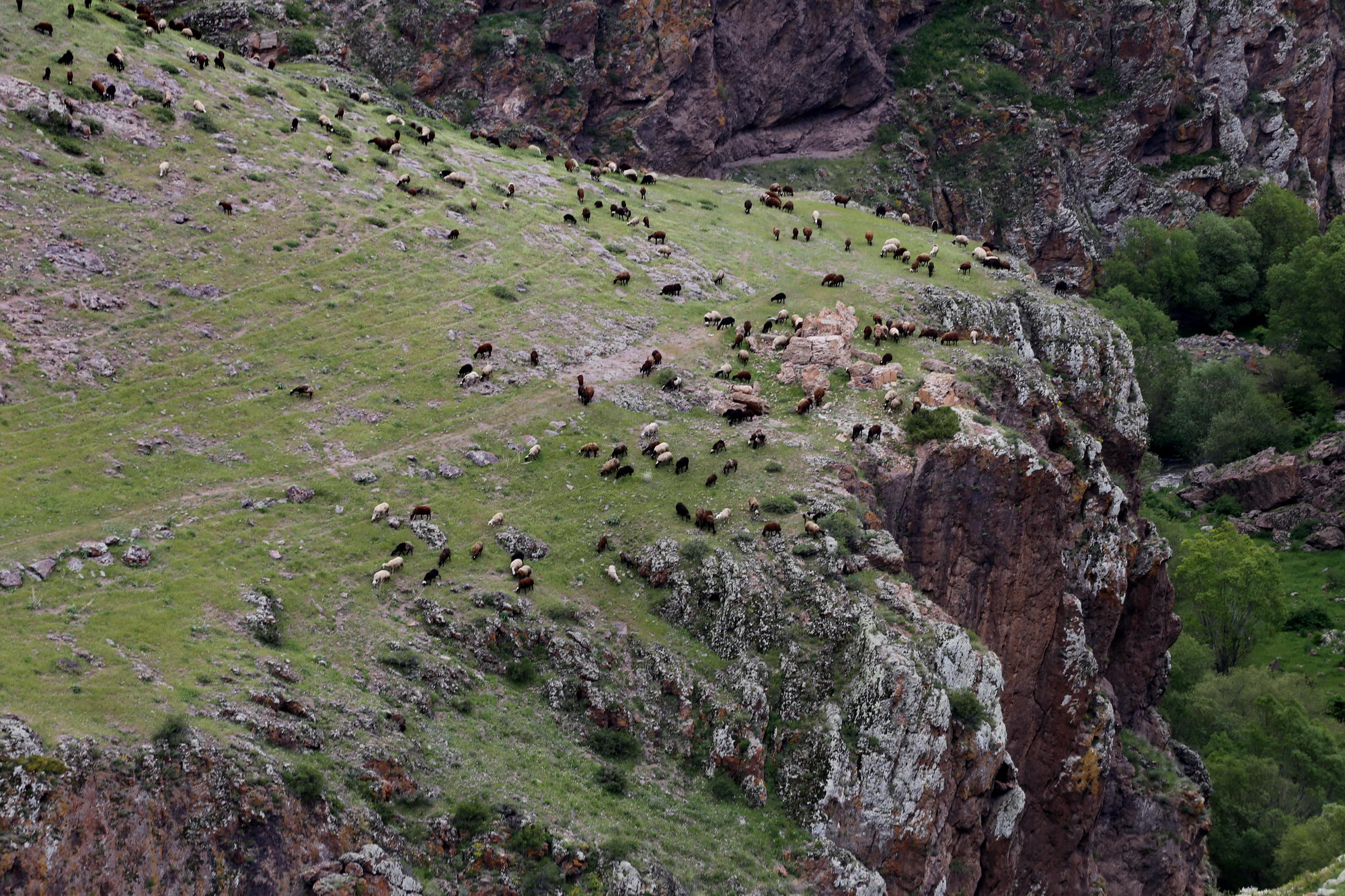
Two routes lead from the village to the church. One is a 4–5-kilometer footpath running along the bottom of the canyon and leading directly to the church. The other is a dirt road, passable by car, toward Derinöz (Ագարակ, Agarak), which runs on the plateau. From a certain point along this road, one can walk out to the canyon rim, from where an excellent view opens toward the church. The two routes do not replace one another: only the first reaches the church itself, but the best overall views can be obtained from the second. We choose the latter.
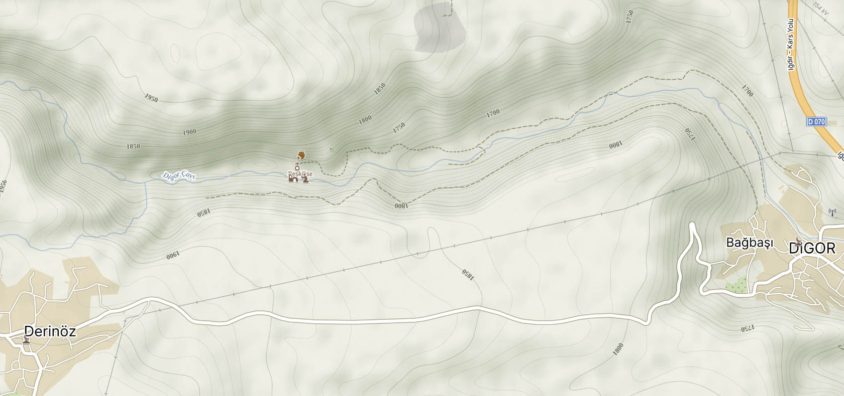
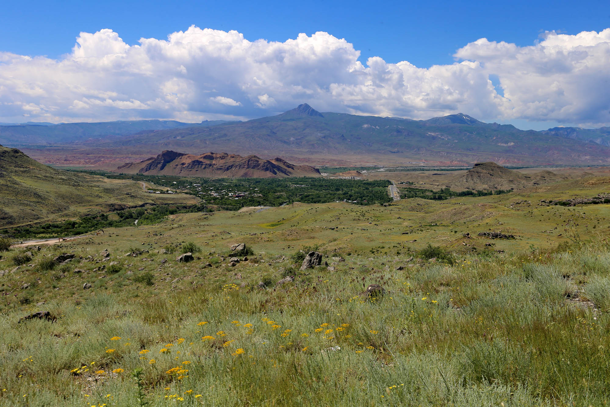
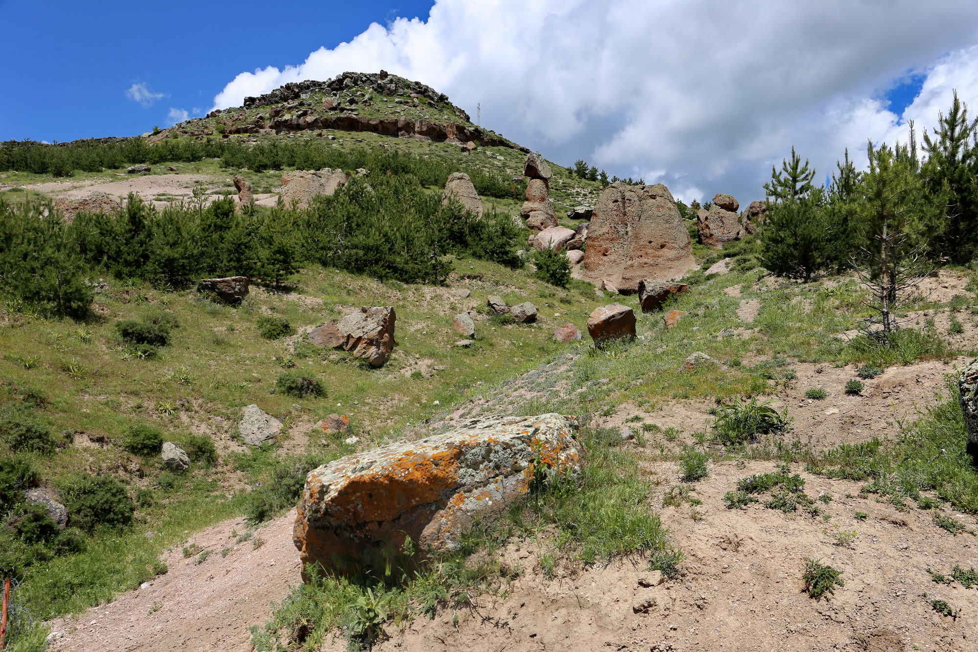
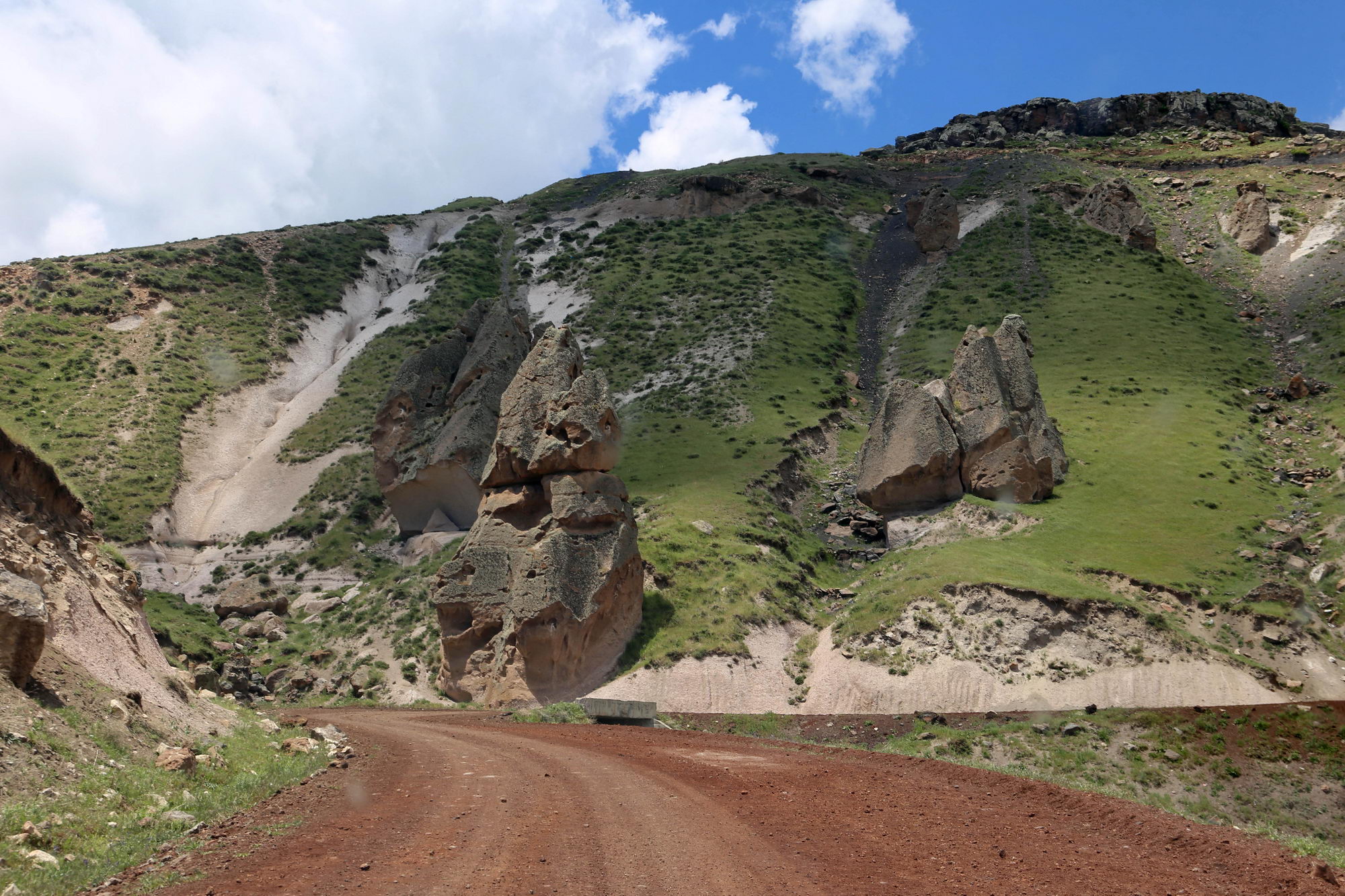
The switchbacks of the dirt road climb ever higher above the village through broad green pastures and among strange rock formations.
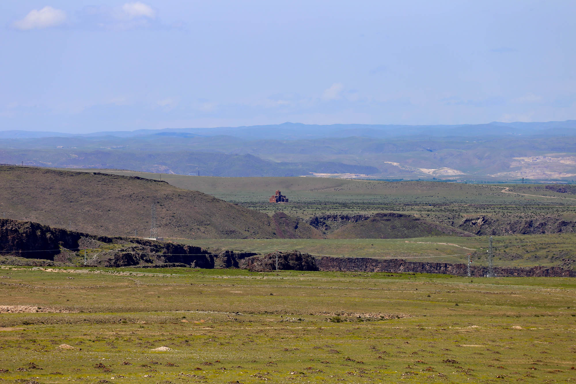
When we reach the point marked on the map, where the church lies closest in a straight line, we stop, but no trail is visible. We walk across cultivated fields toward the canyon. After a while, the terrain begins to slope downward, the ploughed fields give way to flower-covered meadows, and gradually the canyon opens before us.
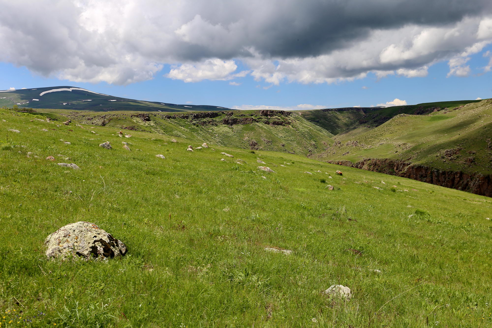
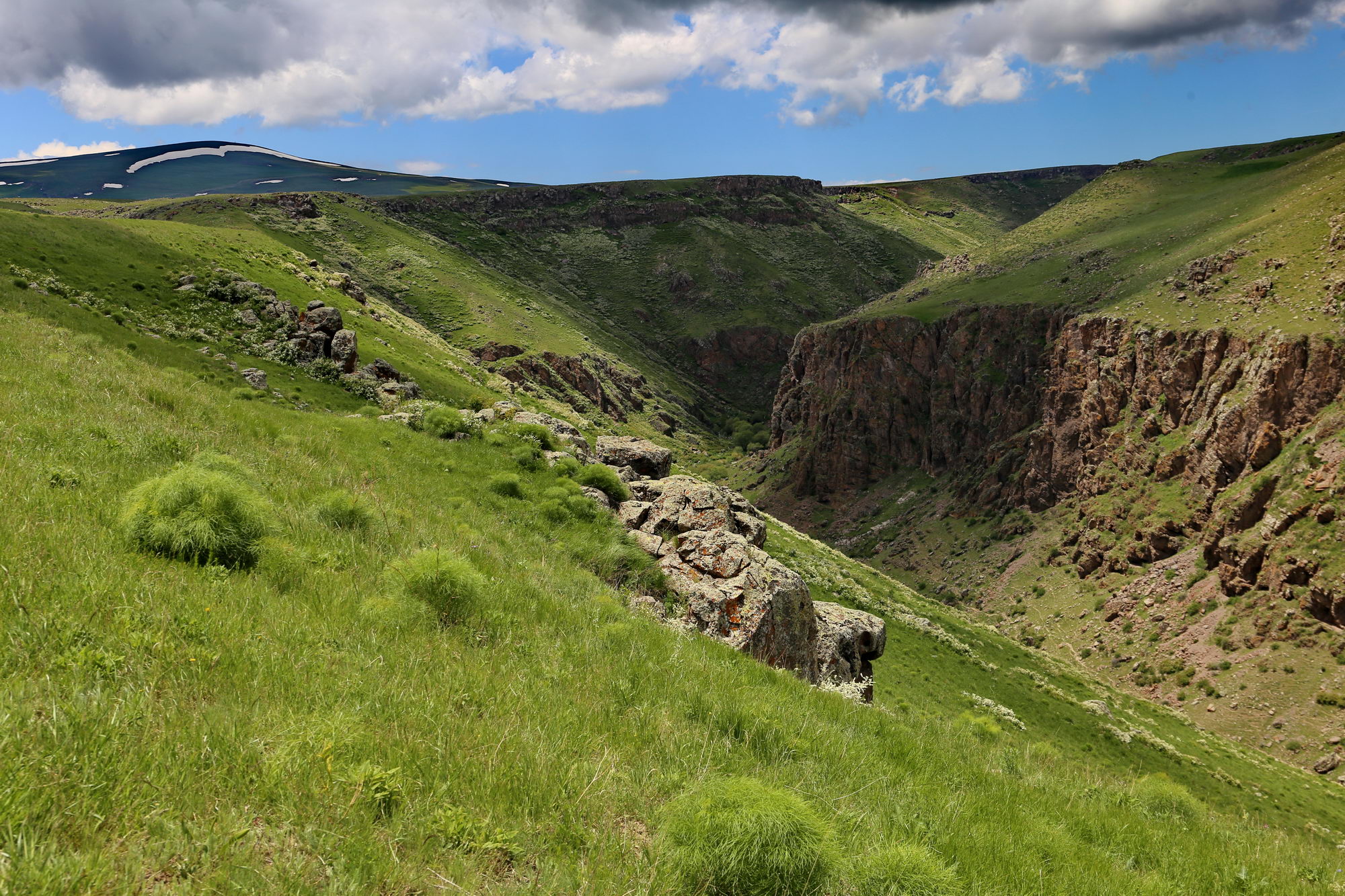
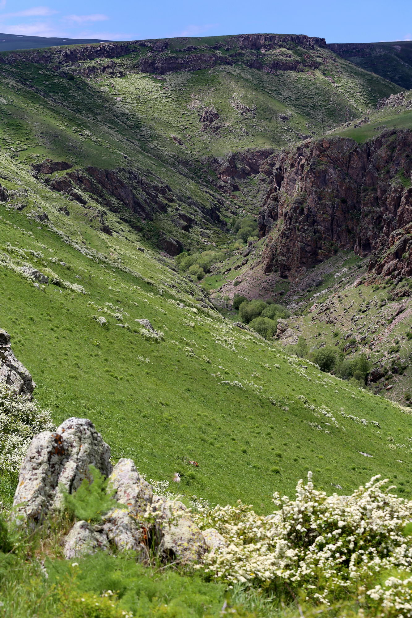
We have to walk all the way to the edge before, looking down, we finally catch sight of the circular church standing on a rock above the river, the lone surviving remnant of the former monastery, small yet resolute among the cliffs in the depths of the canyon.
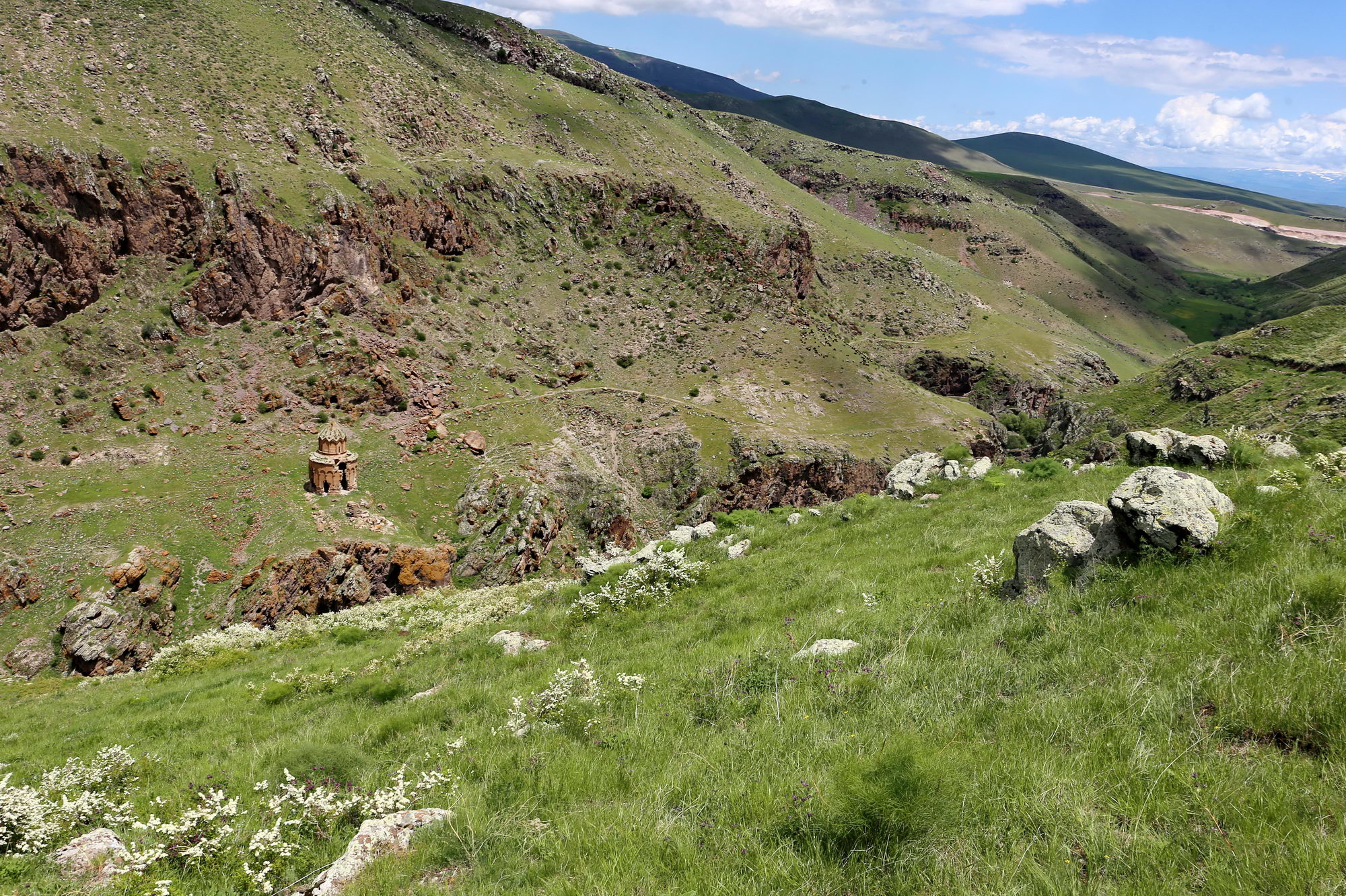
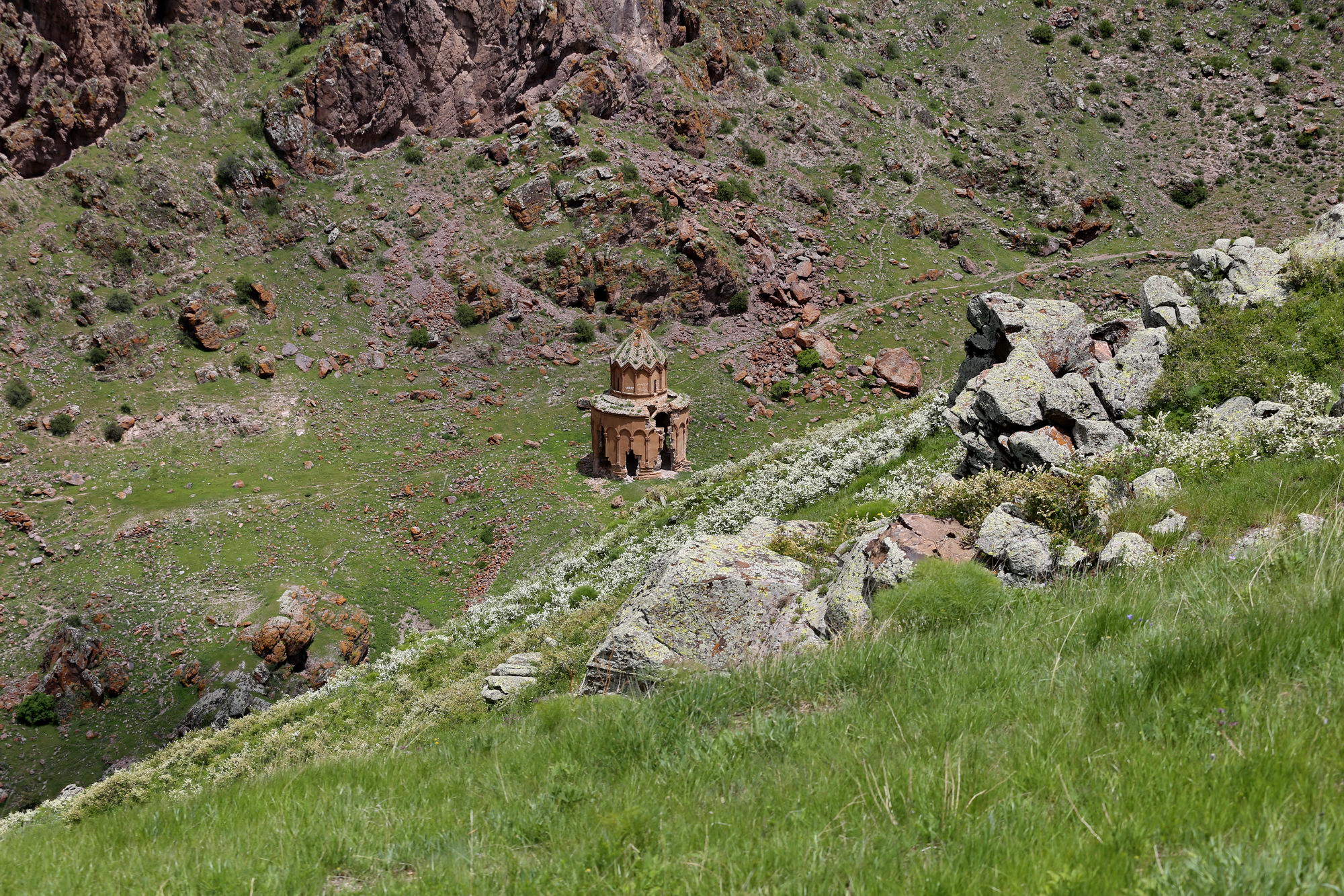
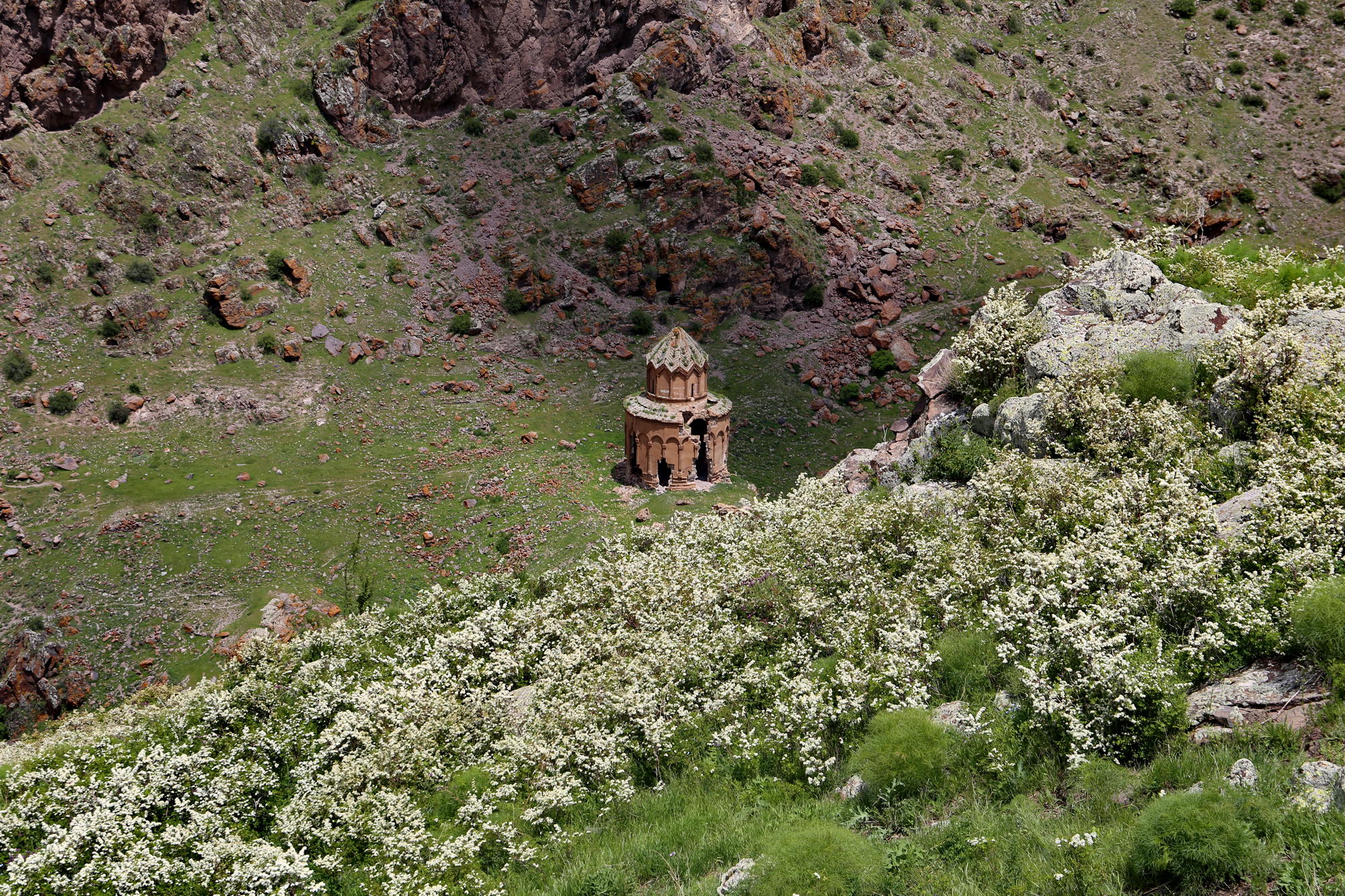
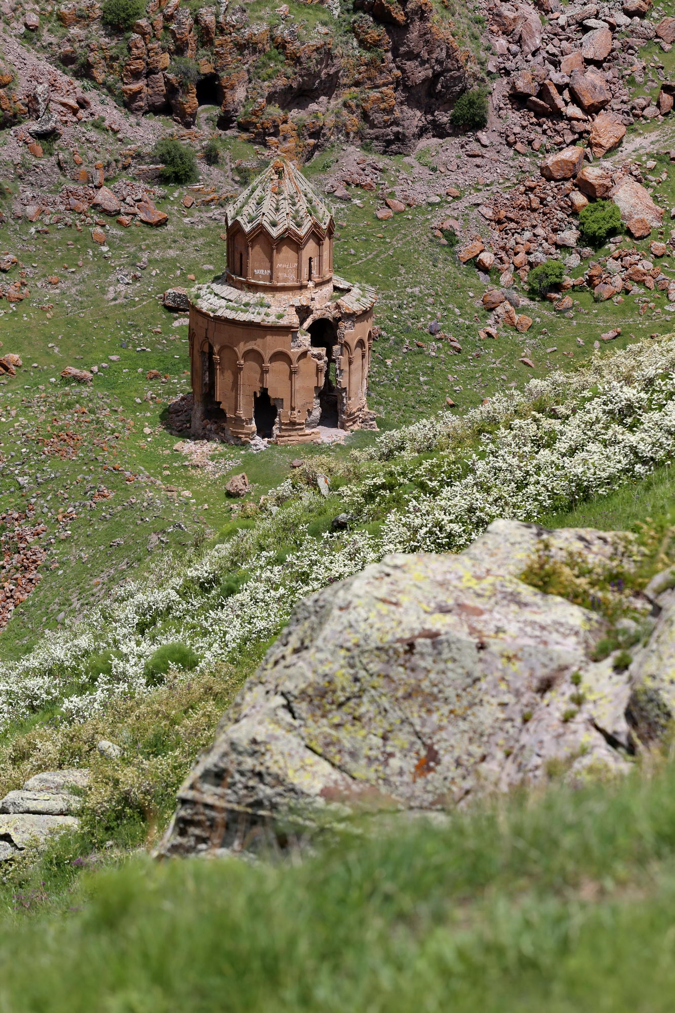
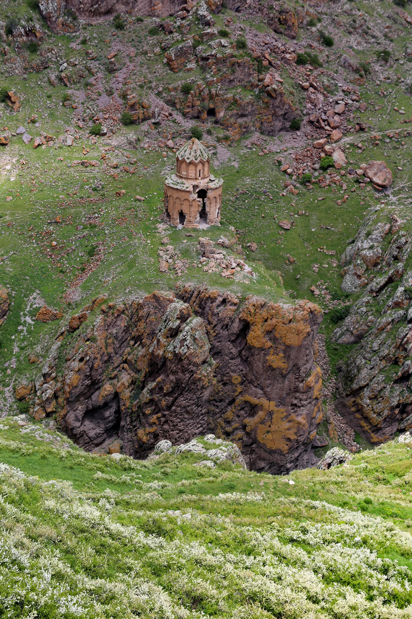
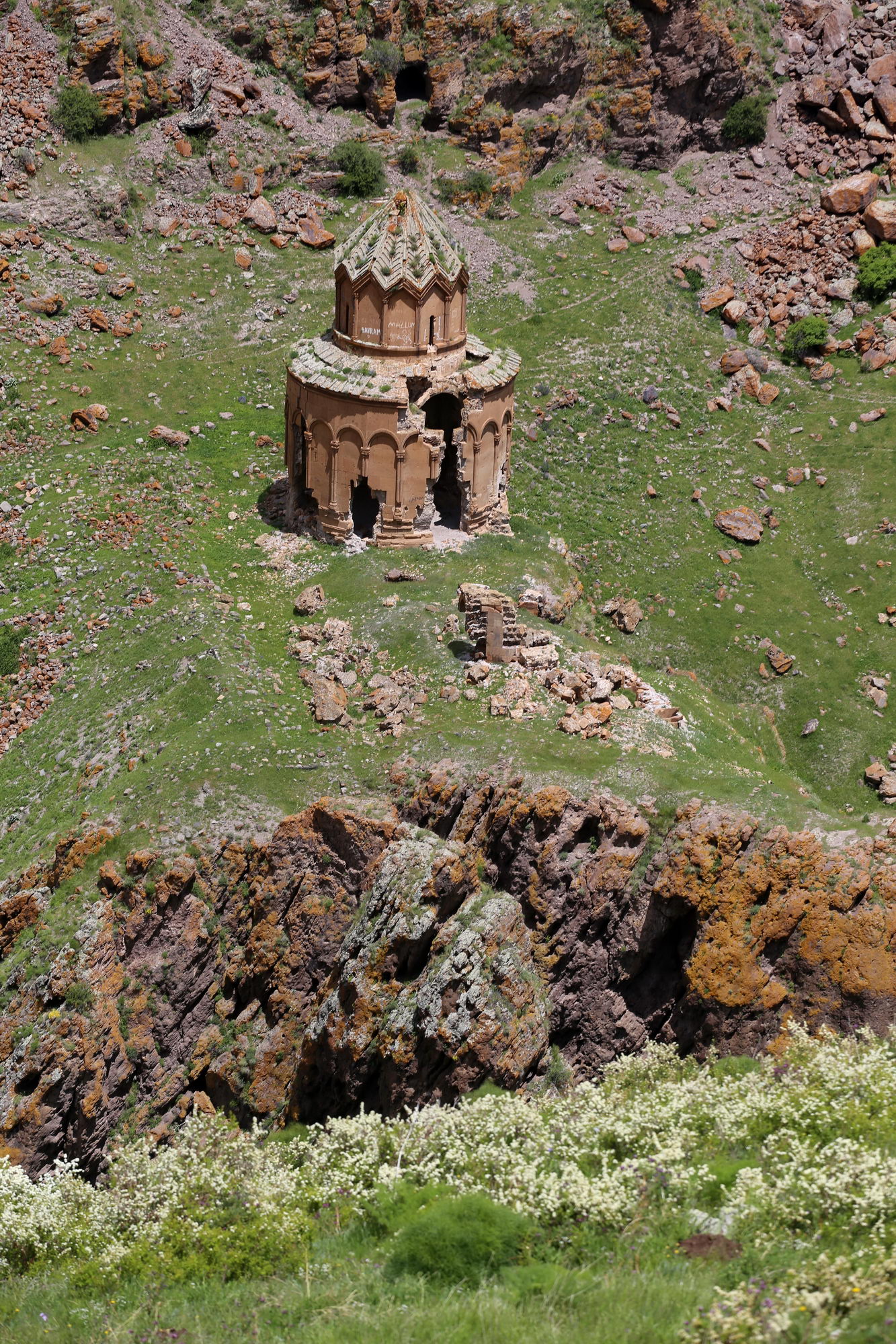
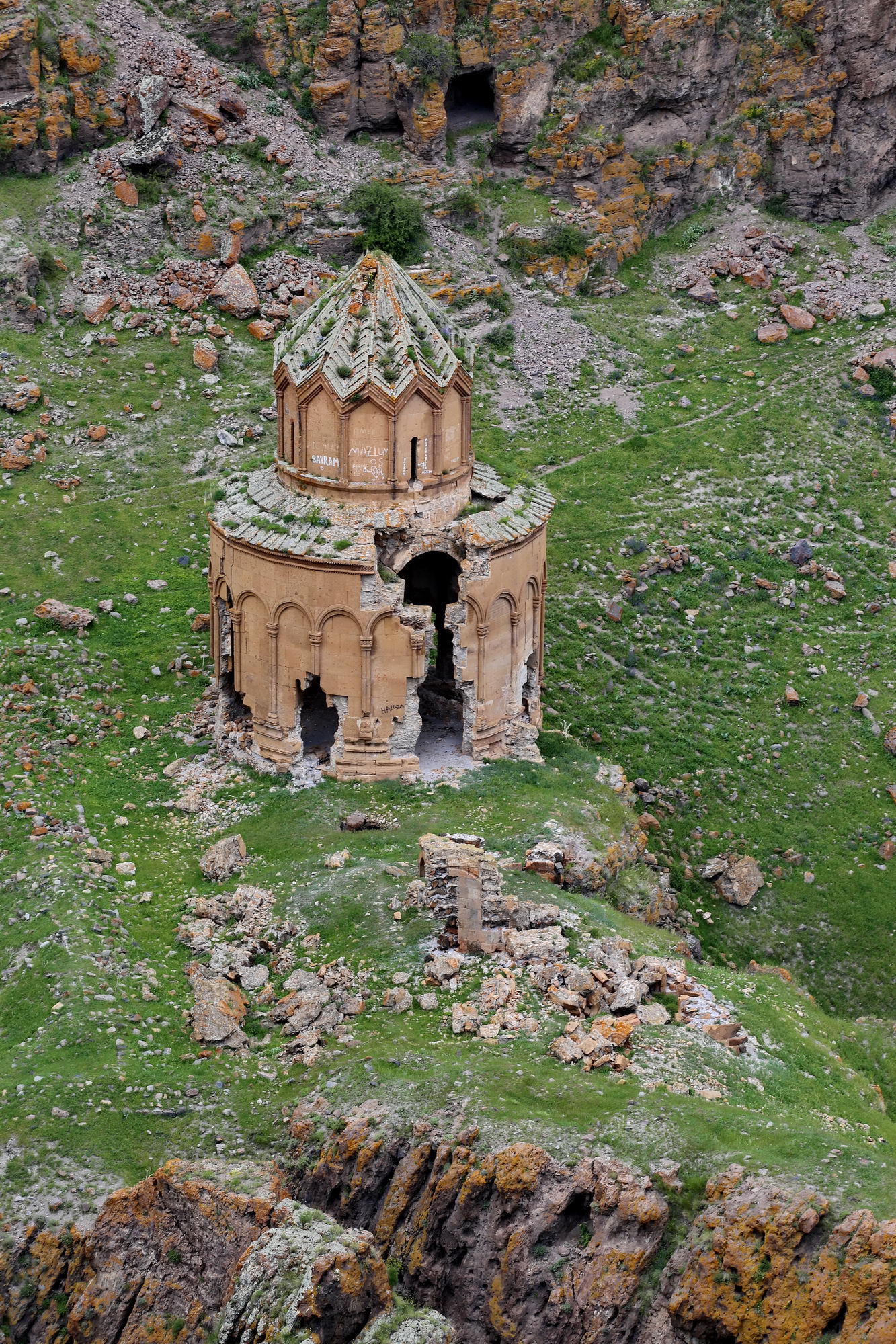
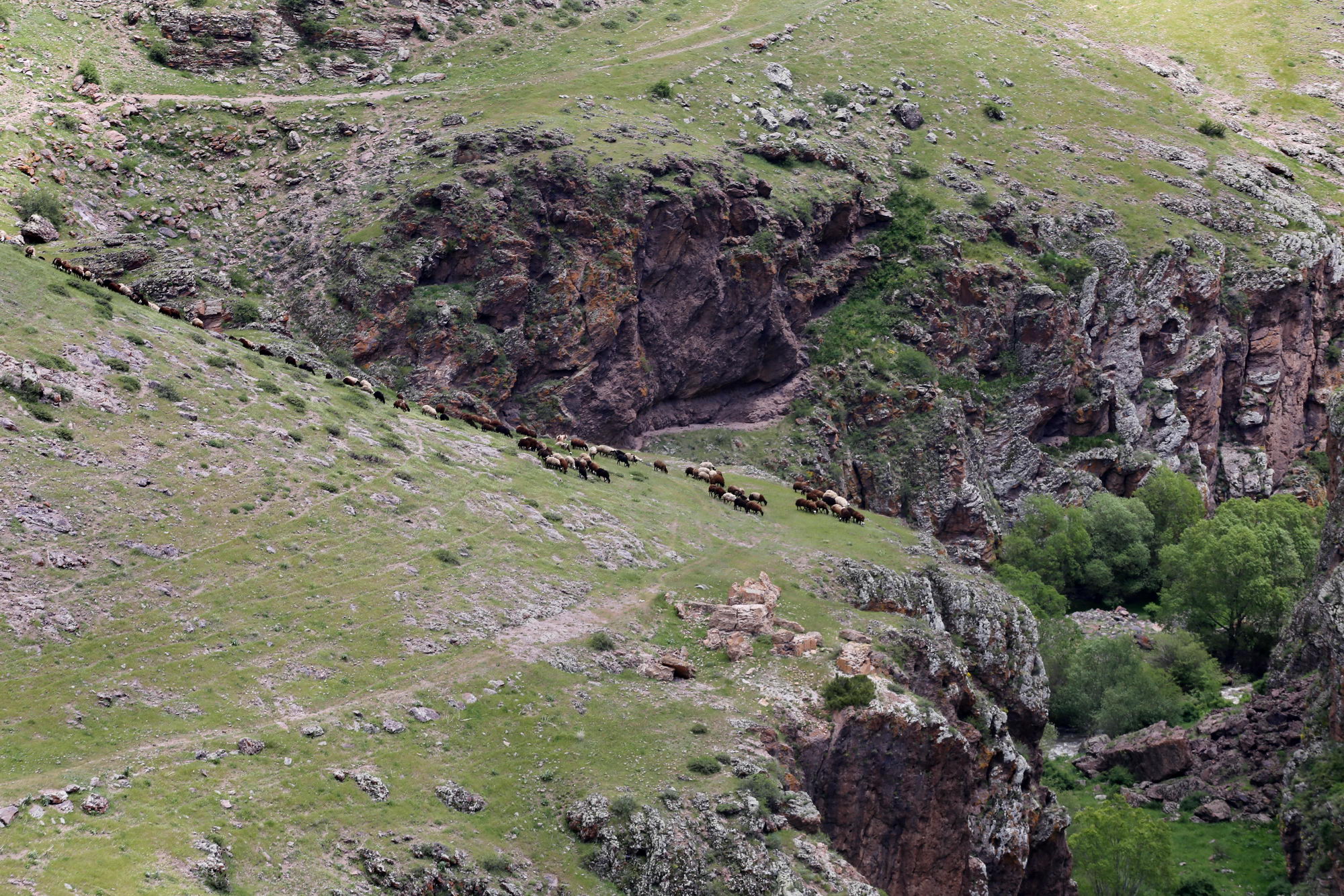
It is indeed relatively well preserved, although dangerous cracks gape in its walls – who knows how much longer it will remain standing. Its roof also survives intact, though now thickly covered with moss. Above it, on the plateau, flocks graze; it is likely used as a sheepfold, like many other ruined churches in the Turkish countryside.


Add comment